A limited area model over the South West Indian Ocean, ALADIN-Réunion, used for cyclone forecast and weather forecast on La Réunion is operational since November 2006. This 10km horizontal resolution model contains specific developments as cyclone bogussing and non-geostrophic balances.
Numerical weather prediction model initialization uses huge amounts of data, mainly satellite measurements.
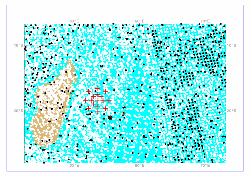
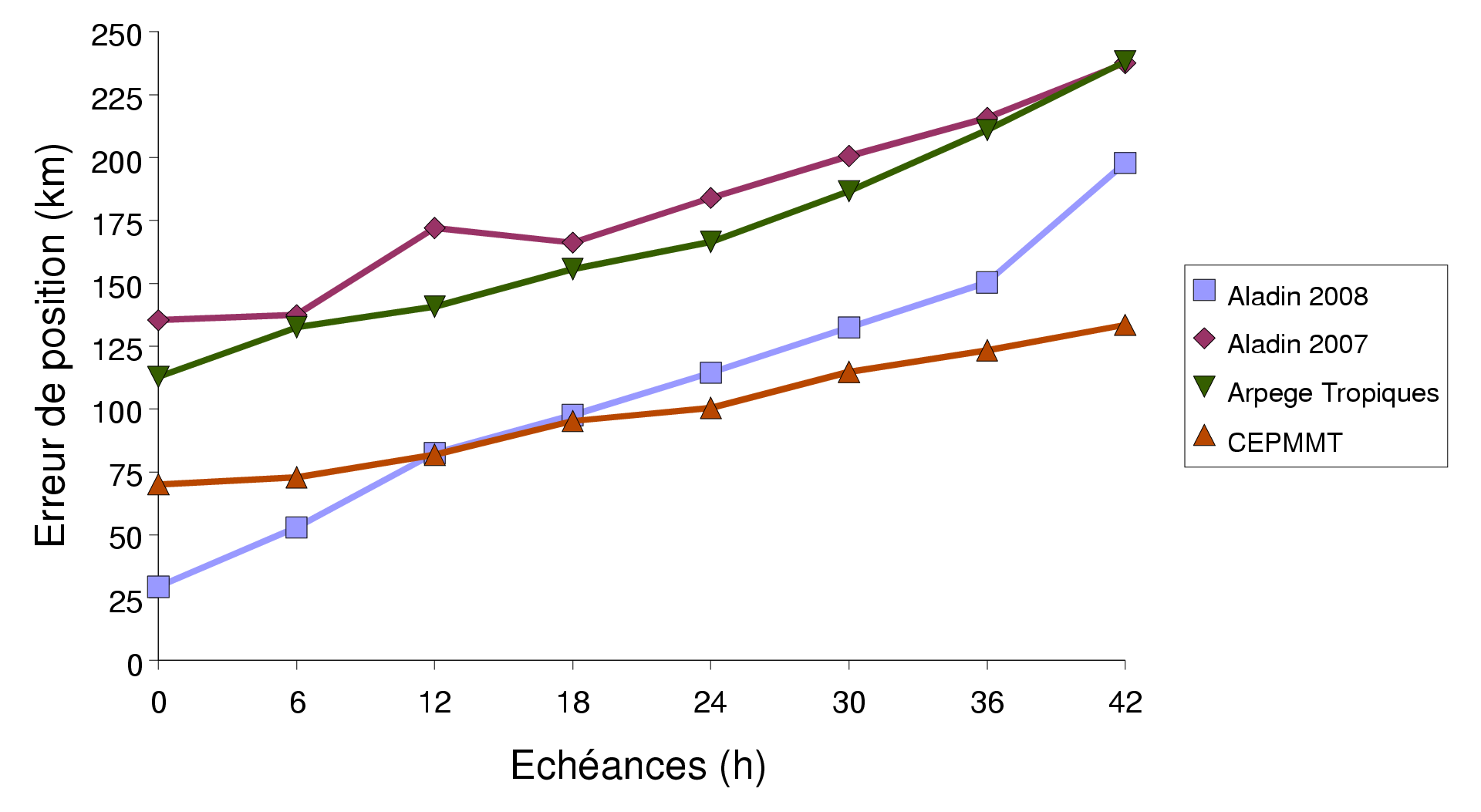
However data finally used in the cyclone body are very sparse (figure 1) because of cloud, rain or strong wind contamination. Thus, the cyclone structure and intensity analysis is very difficult. Dvorak analysis, that forecasters perform by using satellite imagery, gives reliable estimates of the main cyclone characteristics. Based on some of these estimated parameters, analytical models can compute the corresponding three-dimensional cyclone structure. Pseudo-observations, deduced from the latter, are assimilated in Aladin-Réunion model since december 2007. They considerably improve the cyclone analysed and forecast position (figure 2). Great benefits are also visible on intensity forecasts.
With the aim to benefit from the maximum of information available in the cyclone, work is being done to use satellite measurements in cloudy or rainy conditions. The chosen method consists in fitting a statistical multilinear regression between rainy/cloudy SSM/I brightness temperatures, difficult to assimilate because of approximative radiative transfer models in such conditions, and the water vapor content. This last one will be assimilated (for more details, read this article (Montroty, 2007)).
Another important progress for cyclone forecast is to improve the ocean modeling, since it is the main energy source for the cyclone development. Exchanges between ocean and atmosphere take place at their interface by the momentum, heat and latent turbulent fluxes. Their good estimate is crucial to get a good cyclone modeling.
Satellite microwave channels can measure sea surface temperature (SST) through the clouds and then below the cyclone body; it can then well quantify the cooling observed in the cyclone wake. Associated with a new SST analysis using these data, a new turbulent flux parameterization, adapted to strong wind conditions, is being tested on cyclone cases.